Dams on the Brahmaputra River
Dams on the Brahmaputra River
WRITTEN BY AMBIKA VISHWANATH
9 July 2021
Given China’s disregard for international treaties to cooperate over shared waters, with a couple of exceptions, its plans for damming rivers have always raised concerns in the neighbourhood, especially to the south and southwest. This is particularly alarming for neighbours that do not necessarily have a good relationship with the country or are at a disadvantage geographically. India and countries that share the lower Mekong River — especially Thailand, Cambodia, and Laos — fall firmly into this camp. The sheer lack of regional cooperation — on transboundary waters in the Ganga-Brahmaputra-Meghna Basin as well as effective coordination on disaster management and ecological issues in the Himalayan belt — is a cause for concern and detrimental to the future.
Every now and then, news about further dam activity in the Yarlung Tsangpo (as the Brahmaputra is known in China) or drought in the Lower Mekong caused by upstream dams raises alarm bells, bringing this discussion to the forefront. The story as it is usually told is one of apprehension that China will dam the river and India will run out of water. This narrative becomes particularly alarmist and emotive if there are ongoing geopolitical or border issues at play, as is the case today. India’s northeastern states, where the Brahmaputra flows, already face a myriad of extreme weather events and any significant change in water, due to upstream dam activity in China or India, could lead to several other issues.
However, the stakes go beyond merely the quantity and availability of water. Bluster over ‘riparian rights’ over water subverts from bigger issues. Changes in the quality and ecology of the water that will flow into India as a result of excessive damming and hydropower activity, and increased sediment flow, requires attention. Additionally, building mega-dams in an eco-sensitive and highly seismic prone terrain, both in China and in India, can result in various other problems. For instance, over the past three decades, Himalayan glaciers have been melting twice as fast as at the start of the century, with air and surface temperatures increasing across the region. Unchecked human activity that intersects with unstable mountain terrain and shrinking glaciers can increase risks related to seismic activity, landslides, and other natural events. Building large scale dams in this fragile region poses significant threats of flooding or destruction of infrastructure to downstream populations, where manmade borders separating India, China, Nepal or Bhutan will make no difference.
The race for dams
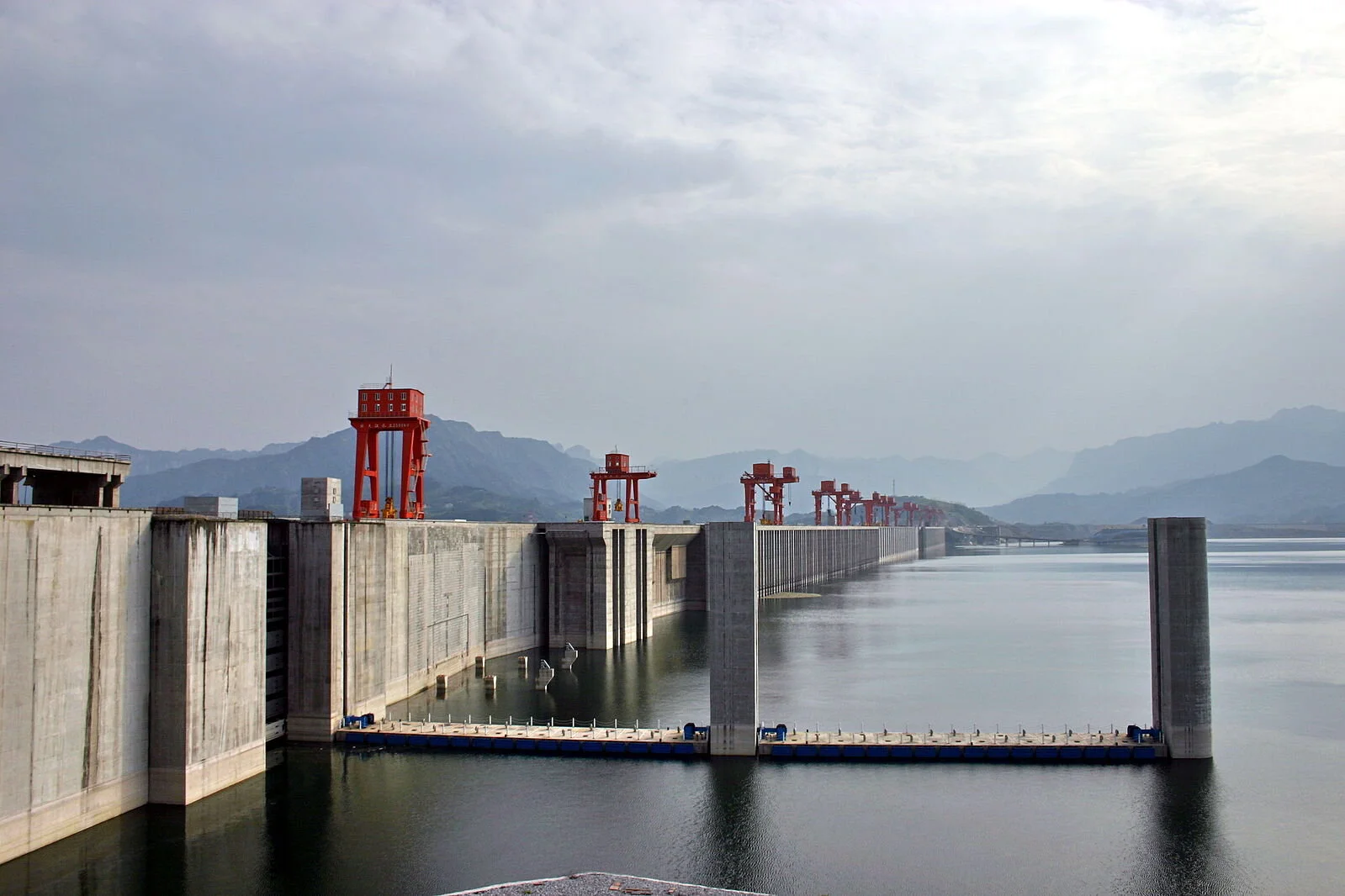
China’s Zangmu Dam, which was completed in 2010 at a cost of $1.5 billion and became operational in 2015, is the biggest hydel power station in the world. Additionally, the Lalho project along with the under-construction dams at Dagu, Jiacha and Jeixu all pose concerns for India and Bangladesh and the millions that live alongside the Brahmaputra River Basin, especially regarding the ecology of the river. These dams, which have been in the works for several years, impose significant economic costs even on a country like China, especially given the terrain, ecology and weather conditions. The Three Georges Dam along the Yangtze River, which took over two decades to construct cost almost $30 billion and displaced over a million people.
It is imperative that Bangladesh, China and India cooperate on the multitude of weather and climate-related issues that will continue to affect the eastern Himalayan region and work with Bhutan and Nepal to create a formal disaster mitigation and management organisation.
A new dam at Medog, to be constructed inside a canyon formed by a bend in the Yarlung Tsangpo in the Tibetan region approximately 30km from India’s border, is now under discussion. This mega-dam will purportedly span the entire river, straddling one of the deepest canyons in the world, and will eventually be able to produce 300 billion kW of electricity annually. Scientists and engineers have questioned the possibility of such a structure, given the terrain and engineering required. Although there is still no concrete information about the project, including the time frame for construction, potential budget, or risk to local communities, it was officially mentioned in the strategic 14th Five Year plan, unveiled at and approved by the National People’s Congress in March 2021. The completion of an important highway through the canyon leading to Medong not far from the Arunachal Pradesh border, and a recent agreement between PowerChina and the Tibet Autonomous Region suggest that these plans are likely to be implemented sooner rather than later.
India plans to counter and mitigate China’s dam-building plans with a similar large dam along the Siang, the main tributary of the Brahmaputra in Arunachal Pradesh, and a series of smaller dams in Assam along the main river. The Upper Siang Project is planned to offset the impact of the Chinese mega-dam, store water that could be released if China impedes flow, and produce 10 GW of electricity. However, building this dam to counter flow impediments is somewhat counterproductive, because Siang and the rivers below are not wholly dependent on China and are largely fed by monsoons on the Indian side. Building a large reservoir on a seismically active zone also seems foolhardy. This knee-jerk reaction will not only endanger millions of people in the Northeast, for whom the river is home and a lifeline but have no say in the national security policy directly affecting them but also adversely affect the river’s ecology, one of the most diverse biological hotspots, in both India and Bangladesh.
The risk
A dam-for-dam building spree is not only short-sighted and unlikely to achieve any of the goals of mitigating impact but also poses unknown ecological, environmental and human costs. This will not only strain an already tenuous relationship between the two Asian giants but also place an unnecessary burden on India’s relationship with Bangladesh. Numerous dams along the river in both India and China will degrade the river, potentially change the quality of soil, affect agricultural output, and endanger a significant portion of the Brahmaputra Basin.
The Himalayan region is prone to earthquakes and other seismic activity that results in flash floods and landslides, which threaten human settlements and infrastructure projects, often built in these eco-sensitive zones. The 2015 Nepal earthquake and glacial flood bursts in 2020 and 2021 in Uttarakhand in India, along with other extreme weather events have caused untold loss of life, livelihoods and property. The 2021 flash floods in Uttarakhand killed over 100 people, damaged a bridge and two hydropower projects, and destroyed numerous homes and livelihoods. In 2018, a landslide in China caused by a melting glacier, a phenomenon that has become more common over the last decade, formed a new lake not far from the proposed dam site in Medog county. Not only does this lake, which sits a few kilometres upstream, pose a threat to any construction activity in the area (from blasting activity for example), attempts to clear this lake and the dam formed by the landslide could prove problematic to downstream regions, causing further floods, excessive silt, infrastructure damage, though all the potential effects are as yet unknown.
New thinking is needed
India and Bangladesh have protested against China’s mega-dam activity, and there has been some level of cooperation on sharing data in this regard, flood management, and disaster warning. However, these efforts are minimal and need to be scaled up, formally institutionalised and broadened to encompass new and unexpected extreme weather events and other areas of disaster and risk management. India and China established the Expert Level Mechanism in 2006, and China provides India flood data on the Brahmaputra from 15 May to 15 October annually. Unfortunately, these arrangements and agreements are often subject to the uncertainties of other geopolitical tensions, as was seen during the 2017 Doklam issue, and need to be better safeguarded. It is imperative that Bangladesh, China and India cooperate on the multitude of weather and climate-related issues that will continue to affect the eastern Himalayan region and work with Bhutan and Nepal to create a formal disaster mitigation and management organisation.
Sharing data, knowledge, local and large-scale best practices will aid all countries in the region and allow states to individually better their future development plans in a more sustainable manner. While it is prudent to assume that the infrastructure race is unlikely to stop, it can be collectively scaled back and a detailed understanding of the region as a whole could help countries balance out the needs for development and ecological sustainability with better mitigation strategies and warning systems. A new approach and new thinking are essential. Regional cooperation should be institutionalised towards collectively safeguarding the Himalayan region as a global common. Any future infrastructure development should be preceded by undertaking climate modelling of the region, based on knowledge and baseline data of glacial movement, formation of lakes, and other changes in weather patterns, and informed by a holistic understanding of the likely risks and hazards. Although BIMSTEC and SAARC have some frameworks that consider coordinated responses and joint capacities on disaster systems, the needs of the Himalayan region fall into a grey area.
Losses due to natural events, exacerbated by human intervention, are clearly trending upward. A massive, coordinated effort with scientific knowledge, detailed risk assessment and a more collaborative approach is needed to mitigate and better deal with inevitable climate-linked weather events. If not, we will continue to witness a dam-for-dam, infra-for-infra race till one day there will be no people left to experience their supposed benefits.
DISCLAIMER: All views expressed are those of the writer and do not necessarily represent that of the 9DASHLINE.com platform.
Author biography
Ambika Vishwanath is the Director of Kubernein Initiative and a water security and geopolitical specialist. Image credit: Wikimedia.